

Overview
- Persistent high pressure keeps the north and northeast largely dry and sunny through at least 3 October, while the south and southwest remain more variable with localized showers and isolated thunderstorms.
- Sunday brings 14 to 21 degrees with around 20 to 21 degrees possible in parts of NRW, the north and the west, followed by a cooling trend to roughly 12 to 17 degrees by midweek.
- The DWD flags widespread morning fog—the so-called “Nebellotterie”—which may linger locally, cutting visibility and holding down daytime temperatures.
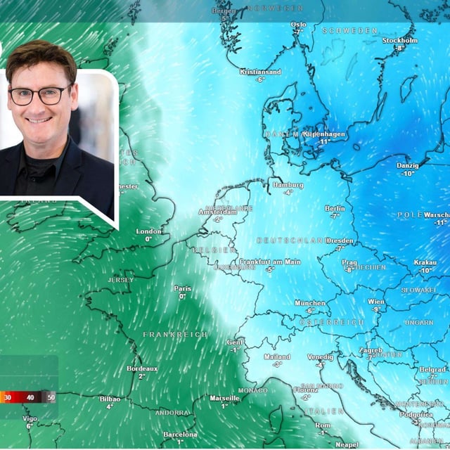
- Light ground frost develops first in the east from Sunday night and becomes more widespread by midweek, with frost-prone spots in NRW and the north also at risk.
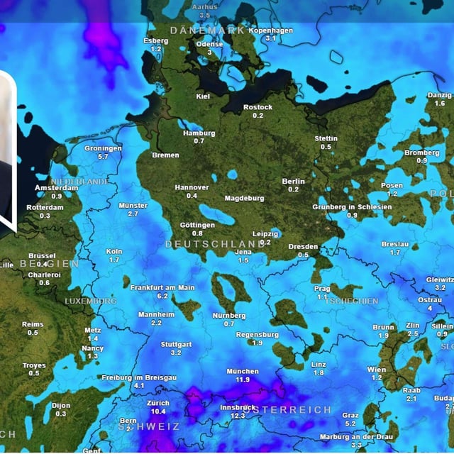
- The Alps are set for light snow at higher elevations next week as the snowline falls below about 2000 meters; on Friday evening, parts of southwest Bavaria were under a level‑2 thunderstorm warning for gusts up to 75 km/h, heavy rain and possible hail.