

Overview
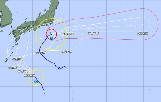
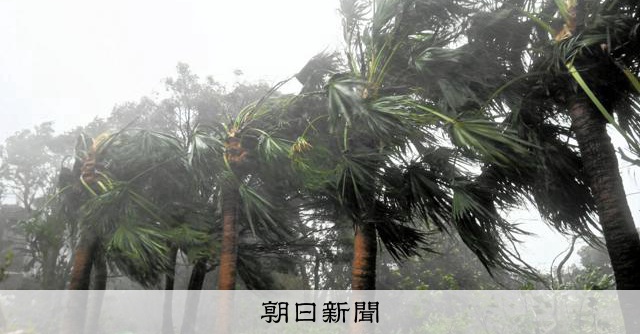
- Japan’s Meteorological Agency issued a heavy-rain special warning for Hachijo Town, after earlier special warnings for violent wind and high waves across seven Izu Island municipalities.
- By early October 9, the typhoon was moving northeast near Aogashima at about 25 km/h with central pressure around 940 hPa, sustained winds near 50 m/s and gusts up to 70 m/s.
- Around 5:30 a.m. local time near Hachijo, about 120 millimeters fell in one hour, prompting record-short-term rainfall information.
- Hachijo logged a maximum instantaneous wind of 50.4 m/s, and a field reporter described noticeable building shaking.
- Officials warn of flash flooding, landslides and possible structural damage as violent winds and thundery downpours continue over the islands.