Overview
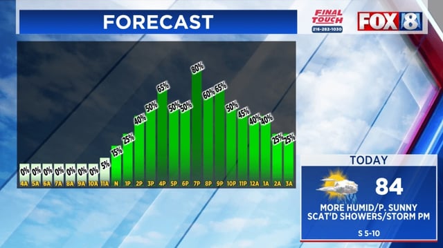
- A cold front is triggering scattered showers and a few storms with roughly 40% coverage this afternoon, while Kentucky squeezes in one more 90-degree day with mid to upper 90s heat indices.
- Heavier rain from earlier is tapering this evening and is expected to fade by around midnight, with only a few sprinkles overnight.
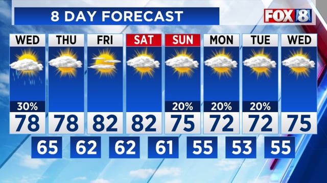
- Behind the front, northwest winds bring breaks of sun and a cooler stretch Wednesday, with spotty showers and highs in the mid to upper 70s.
- Temperatures briefly rebound Friday and Saturday before another push of cooler, drier air arrives.
- Next week turns more fall-like, with highs in the 70s and lows settling in the 50s.