Overview
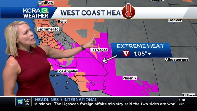
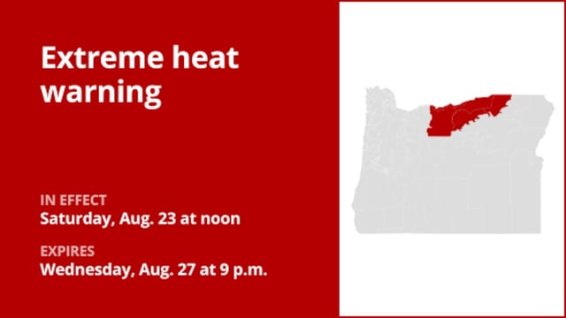
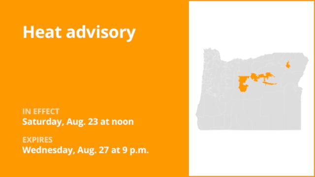
- National Weather Service heat advisories and extreme heat warnings cover much of California, with interior valleys in the 90s to low 100s and lower deserts forecast near 111–115 degrees through the weekend.
- Bay Area coastal zones begin to cool with strengthening onshore flow, but inland locations and the Central Valley stay hot into Sunday, and Los Angeles area valleys remain near or above 100 degrees on Friday and through the weekend.
- Forecasters expect thunderstorms to expand across the Sierra and other ranges through the weekend as monsoonal moisture increases, with a transition from dry lightning risk on Friday to wetter storms and localized flash flooding.
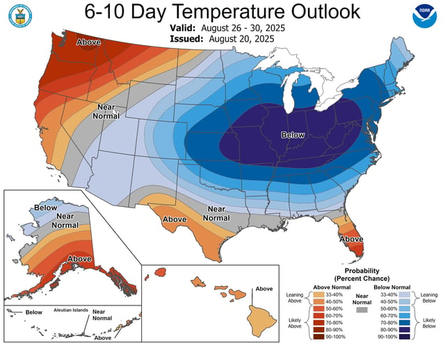
- A strong cold front is set to deliver a sharp temperature drop to the Midwest and into the Northeast early next week, with some upper Midwest locations facing late‑August frost potential and highs up to 25 degrees below average.
- Southern California forecasters anticipate a gradual cooling trend early next week with some areas returning near seasonal averages by Tuesday, though heat hazards linger for interior valleys and deserts before relief arrives.