Overview
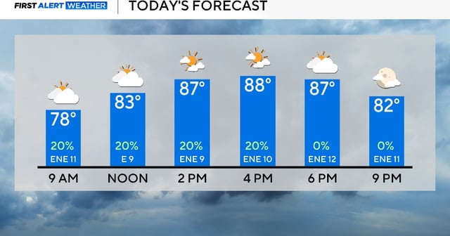
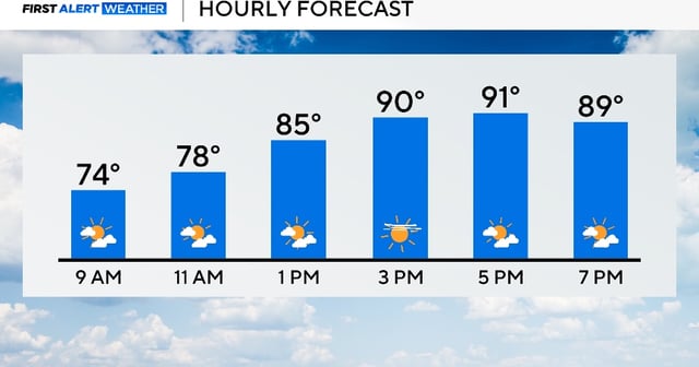
- A warm front is lifting north today, bringing a quick return to low 90s this afternoon and setting up mid to upper 90s on Thursday in the DFW area.
- Dew points near 70 will make it feel like 102–104 degrees on Thursday before the next cold front arrives by evening.
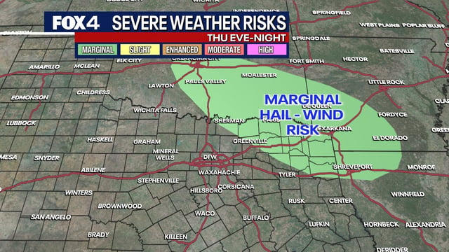
- The front Thursday night into Friday is forecast to trigger scattered showers and storms, with the strongest activity favored across northeast Texas and the Ark-La-Tex.
- Weaker storms are possible in the Metroplex overnight, and highs will fall back into the 80s on Friday with north winds and more cloud cover.
- Remnants of Tropical Storm Juliette are forecast to pass through on Saturday, increasing clouds and showers and keeping highs in the mid-80s.