Overview
- Highs in the low 90s persist through the weekend across Houston and southeast Texas, running warmer than typical for early October.
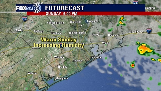
- Only isolated showers are expected today and Sunday, with a better chance for a few storms late Sunday into Monday and Tuesday.
- The National Hurricane Center is tracking a northern Gulf disturbance that may help spark local showers Monday, while a Bahamas-area low has a low formation chance and an Atlantic wave has higher odds to organize next week.
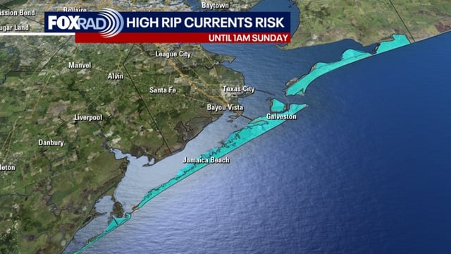
- A High Risk of Rip Currents is in effect for Gulf-facing beaches through Sunday night due to persistent easterly winds.
- Dryness and moderate drought are expanding west of Houston, raising brushfire danger, and gusty winds today could worsen allergy symptoms.