
Overview
- A Heat Advisory remains in effect through 8 PM Friday as gusty south winds and dew points in the upper 60s maintain warm, humid conditions
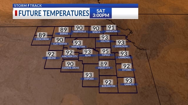
- Highs will reach around 90 °F Friday and climb into the mid-90s on Saturday before storms arrive
- Strong storms are likely Saturday night into Sunday as the approaching trough brings heavy rainfall to central and eastern Kentucky
- Lingering showers Monday and Tuesday will push daytime temperatures into the lower 80s and keep early-week conditions damp
- A southwest ridge will rebuild by midweek, restoring 90 °F heat and mostly dry skies later in the week