

Overview
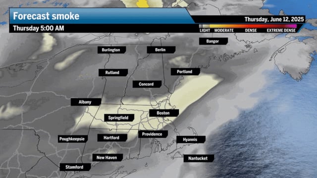
- As of June 12, highs reached the mid-80s under a thin layer of Canadian wildfire smoke, producing hazy skies across Greater Boston and Southern New England.
- Friday will remain mostly dry with upper-70s temperatures and a mix of sun and clouds as a stalled frontal boundary lingers just south of the region.
- Overnight lows will hold in the 50s to low 60s before Saturday’s front drives day-time highs more than ten degrees below average.
- Widespread showers are expected Saturday morning as the front moves through, with high pressure in northern New England sustaining a cool northerly flow into Sunday.
- Ocean temperatures in the upper 50s will keep coastal waters chilly and air quality will stay moderate until the front finally clears remaining smoke.