
Overview
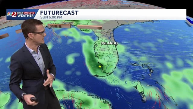
- Scattered showers and storms persist from the Gulf Coast into the Southeast with localized 1–3+ inch totals, including 2–4 inches reported in parts of southeast Georgia and the Lowcountry.
- Hazardous surf and marine conditions continue in spots with dangerous rip currents, breaking waves of several feet, gusts near 25–35 mph, and the risk for minor coastal flooding at high tide.
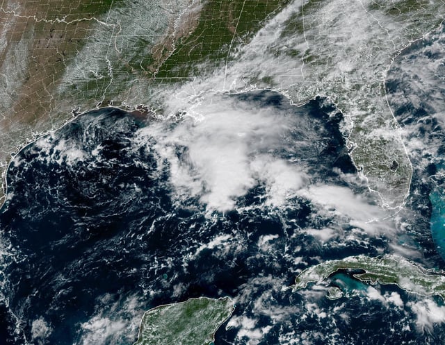
- A weak trough over the north-central Gulf is funneling moisture into coastal areas but carries a 0% chance of tropical development, according to the National Hurricane Center.
- Invest 95‑L in the central/eastern Atlantic holds a high likelihood of forming into a depression or named storm by midweek, with most model guidance suggesting a northward turn over the open Atlantic away from the U.S.
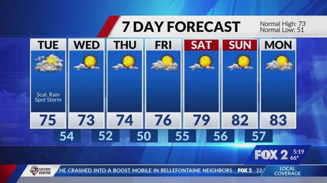
- The approaching front is expected to produce generally light to moderate rainfall Tuesday night into Wednesday before ushering in a noticeable cool-down and drier conditions late week.