

Overview
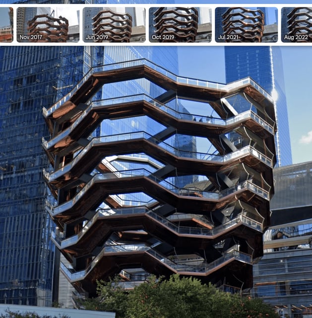
- Users can explore past decades of Street View imagery by dragging the pegman icon onto a location, selecting “see more dates,” and using the filmstrip menu to choose a year.
- Google Earth resurfaces its 3D timelapse feature with satellite-based animations that chronicle landscape changes over time at sites such as Notre-Dame de Paris, Berlin, Las Vegas, and San Francisco.
- Google Earth Pro will soon gain AI-driven urban planning tools, including tree canopy coverage analysis and land surface temperature heatmaps.
- The historical Street View feature was inspired by a social media trend in which users shared archival Google Maps imagery of landmarks and neighborhoods.
- Google Earth is accessible on the web, in mobile apps, and through the Google Earth Pro desktop application.