Overview
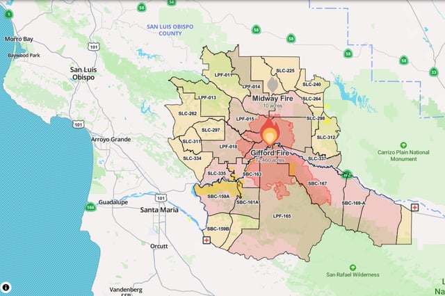
- Investigators are probing how four separate ignitions along State Route 166 merged into the Gifford Fire on August 1.
- Three people have been injured, including a motorist burned after fleeing his vehicle and two contractors hurt in an overturned ATV.
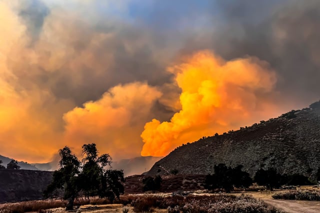
- Smoke from the blaze has degraded air quality as far south as San Diego and east into the Las Vegas Valley.
- Nearly 2,000 firefighters, supported by engines, hand crews, bulldozers and water tenders, are attacking the fire under a unified command.
- Evacuation orders span nine zones in San Luis Obispo and seven in Santa Barbara County, placing more than 870 structures under threat.