
Overview
- After a cool, wet week under a lingering low, preliminary DWD data show up to 77 liters per square meter in 24 hours at Grünstadt-Sausenheim, with impacts described as limited.
- On Friday it stays mostly cloudy with rain from the southwest into central regions, while earlier mountain reports cited gusts up to about 80 km/h at Fichtelberg and Brocken.
- Saturday favors sunshine north and northeast of the Elbe as clouds and showers persist farther south, with the DWD flagging a risk of strong thunderstorms in southern Bavaria.
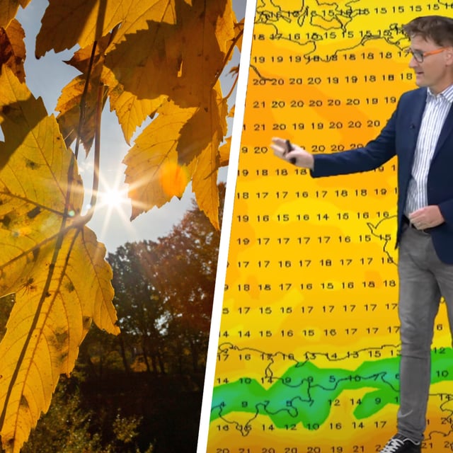
- By Sunday many areas turn dry and milder with highs around 15 to 21 degrees, locally up to 22 degrees in spots, though a few showers may linger near the Alps.
- A marked north–south split continues with morning fog or low cloud in places and cooler mid‑teens in parts of the south before the warmer, brighter conditions expand.