


Overview
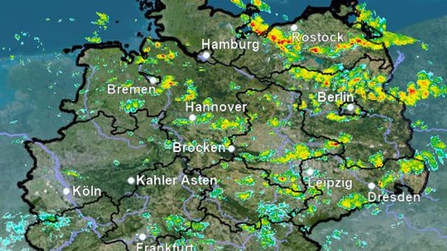
- DWD has issued official warnings for strong thunderstorms and wind in the northeast, with Berlin and Brandenburg seeing gusts around 65–75 km/h and daytime highs of only 16–19 °C.
- Showers and thunderstorms shift regionally through the weekend, with the DWD cautioning that localized downpours up to about 30 l/m², hail and sturmböen are possible on Sunday from the east toward Bavaria.
- Night temperatures dip sharply in places to 4–8 °C with a risk of ground frost in clear, higher areas, reinforcing the unusually cool spell for late August.
- Baden‑Württemberg enters a mostly dry, brighter stretch under high pressure through Tuesday, with highs climbing from about 23–25 °C on Sunday to roughly 27 °C Monday and near 30 °C on Tuesday in the Breisgau.
- An ex‑hurricane system known as Erin is forecast to redirect warm air over Germany early next week, raising highs broadly into the 25–33 °C range by Tuesday and Wednesday.