


Overview
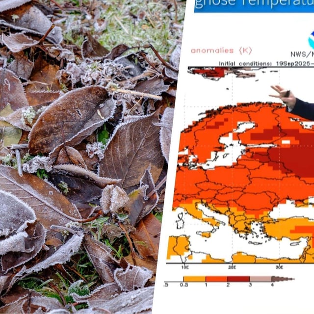
- Before the shift, the DWD expects mostly sunny days but cold nights with widespread ground frost and local fog, especially inland and in valleys.
- Official alerts note early‑season Alpine snow above about 2,000 meters with roughly 5 to 10 centimeters common and up to around 20 centimeters in windward zones.
- Rain and a surge of wind arrive from Friday night into Saturday, with the DWD warning of possible severe gusts; models indicate around 60–80 km/h inland, near 100 km/h at coasts, and up to about 120 km/h on high peaks like the Brocken.
- Heavy rain is likely in windward ranges where 24‑hour totals can exceed 30–40 l/m², with stürmische conditions forecast for the North Sea and a wet, blustery finale expected for events such as the Oktoberfest.
- Sunday stays unsettled with further gusts, and some forecasts suggest a brief warm rebound early next week above 20°C, though forecasters stress that outcome remains uncertain.