

Overview
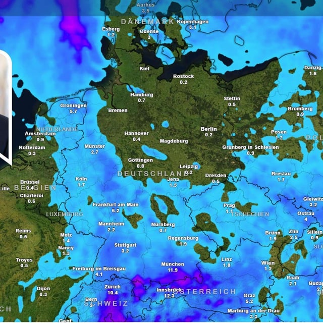
- The DWD issued a level‑2 warning for strong thunderstorms in southwest Bavaria on Friday evening, covering Unterallgäu, Memmingen, Ostallgäu, Oberallgäu, Kempten and Lindau, with risks from lightning, 75 km/h gusts, heavy downpours around 20 l/m² per hour and possible hail.
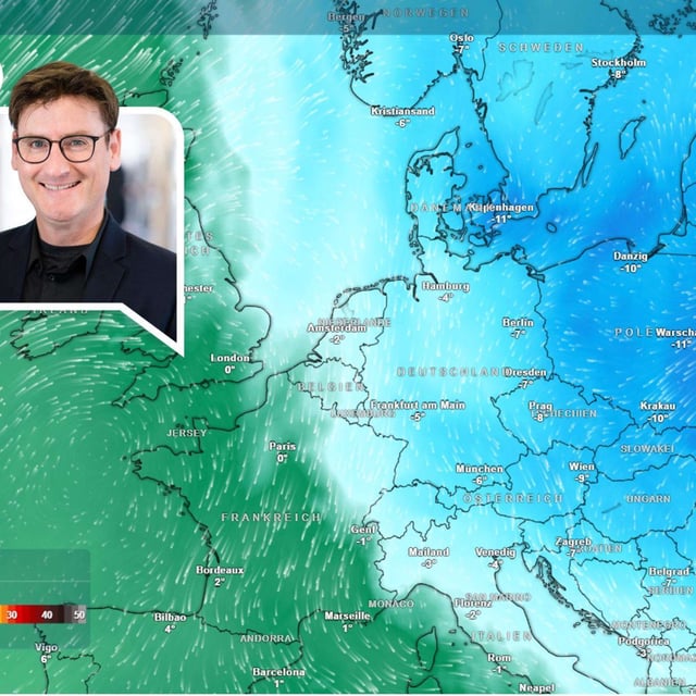
- A strengthening high over northeastern Europe (Petralilly) stabilizes weather in the north and east, where Sunday is widely friendly and dry with highs between 14 and 21 degrees and local 20‑plus readings in NRW and the north.
- Early this week stays mostly dry aside from a weak disturbance bringing scattered showers and isolated thunderstorms in the southwest, while cloud and patchy rain linger near the Alps.
- Nights turn markedly colder as the easterly flow settles in, with the DWD expecting ground frost from Sunday in the east and more widely by midweek; NRW forecasters note valley lows near -1 degree on Wednesday morning.
- In the Alps, the snowline drops below roughly 2,000 meters during the coming days, bringing renewed summit snowfall, and experts urge caution with month‑ahead October projections given their limited reliability.