
Overview
- Ground frost was recorded early Monday at select stations, including −1.6 °C in Burgwald-Bottendorf (Hesse) and −1.0 °C in Eslohe (Sauerland), unusual values for August.
- A rapid warm-up is forecast to lift highs to around 30–32 °C on Tuesday and Wednesday, especially in western and southern Germany.
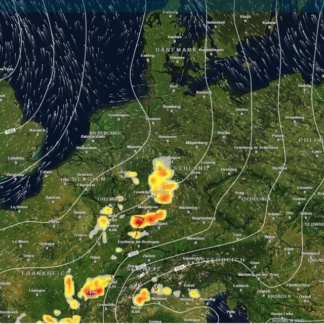
- From the night into Wednesday, thunderstorms are expected to develop, with the highest risk for central and southern states through the late week period.
- Forecasters warn of heavy rain, hail and strong gusts, with localized downpours capable of quickly flooding roads and causing damage to cars and roofs.
- Rain and storms are projected to spread more widely by late week as temperatures ease to roughly 19–27 °C, with 10–30 l/m² of rainfall possible and higher amounts in the southwest and the Allgäu.