


Overview
- The national weather service (DWD) keeps widespread ground‑frost alerts in place through Thursday night into Friday, with official warnings in Bavaria and parts of North Rhine‑Westphalia and advice to protect sensitive plants.
- Motorists are cautioned about dense fog with visibility below 150 meters and slick spots where frost or light Alpine snow occurs, with 5–10 cm above 2000 meters and up to 20 cm in windward areas.
- Midweek stays mostly sunny and dry with daytime highs around 10–17 °C, before a milder pulse reaches the southwest on Saturday, locally touching about 22 °C in the Breisgau.
- From late Friday, cloud and rain advance from the west; by Saturday rain is widespread with strong to stormy gusts on coasts and higher peaks and a risk of heavier totals in the Black Forest.
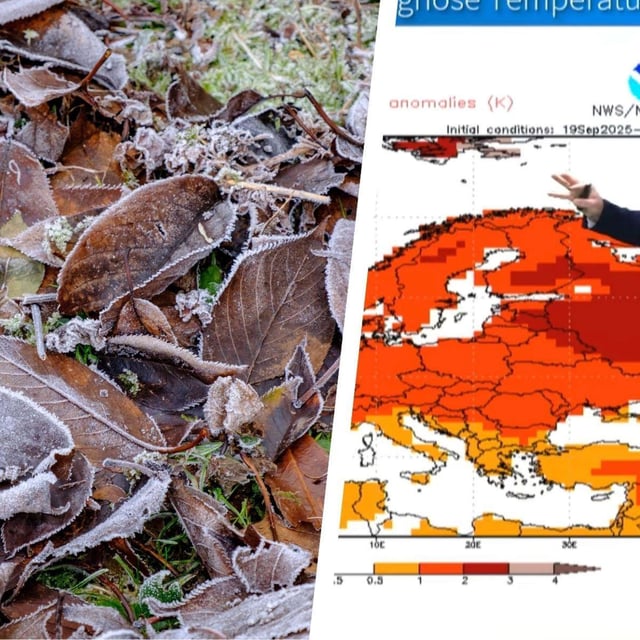
- Meteorologists are tracking ex‑tropical systems Humberto and Imelda that could briefly pull much warmer air into Germany early next week, a scenario still described as uncertain.