Overview
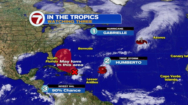
- Hurricane Gabrielle carries a hurricane warning for the Azores with storm surge, damaging winds and large, destructive waves expected tonight into Friday, and its swells are producing life‑threatening surf and rip currents from Bermuda to the U.S. East Coast and Atlantic Canada.
- Tropical Storm Humberto, about 480–505 miles east‑northeast of the northern Leeward Islands with 45 mph winds, is forecast to steadily intensify into a hurricane and possibly a major hurricane next week, with no U.S. coastal watches or warnings in effect.
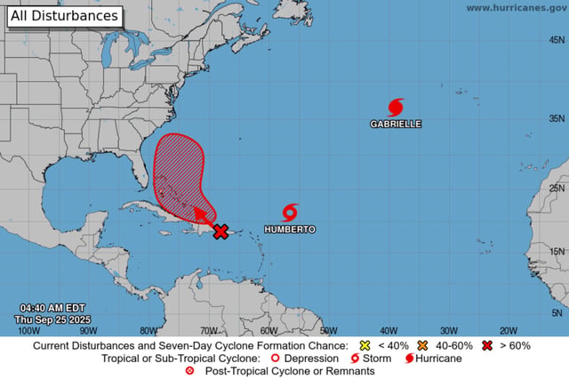
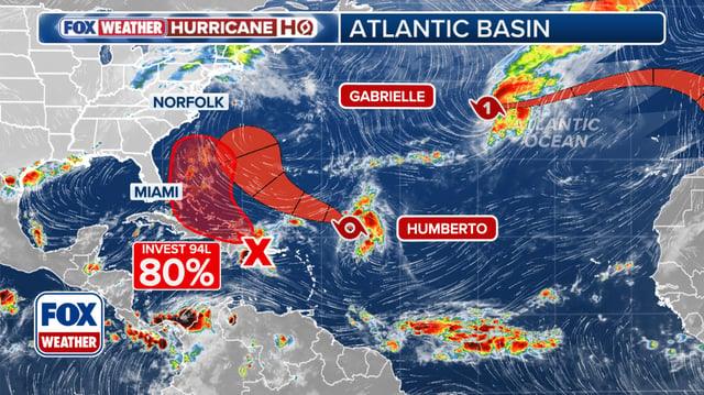
- A tropical wave labeled Invest 94L near the Dominican Republic and Puerto Rico has a 50% chance of development in 48 hours and 80% in seven days, with likely formation near the Bahamas after bringing heavy rain and gusty winds to the northeastern Caribbean.
- Forecasters highlight divergent model guidance on Humberto’s track and the potential for Fujiwhara‑style interaction with 94L, which could shift paths and influence any U.S. coastal exposure.
- NOAA aircraft are flying frequent reconnaissance to feed models as a U.S. East Coast trough and evolving storm sizes and spacing determine whether impacts stay offshore or brush areas from the Bahamas to the Carolinas.