Overview
- Two Science studies published July 24, 2025, report that marine protected areas with explicit industrial fishing bans averaged only five vessels per 100,000 square kilometers compared to 42 in unprotected coastal waters.
- A broader analysis of 6,021 MPAs between 2022 and 2024 detected industrial fishing in 47% of sites, often matching or exceeding effort in nearby unprotected zones.
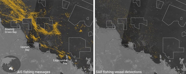
- AIS data alone missed nearly 90% of fishing vessels identified by synthetic aperture radar, underscoring the need for combined remote sensing and AI tracking.
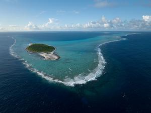
- About 96% of no-take MPAs spanning roughly 7.9 million square kilometers experienced less than one day of illegal fishing each year, affirming the effectiveness of strict legal protections.
- Researchers say satellite-based monitoring can cut enforcement costs and guide national patrols, bolstering compliance toward the 30% ocean protection target by 2030.