Overview
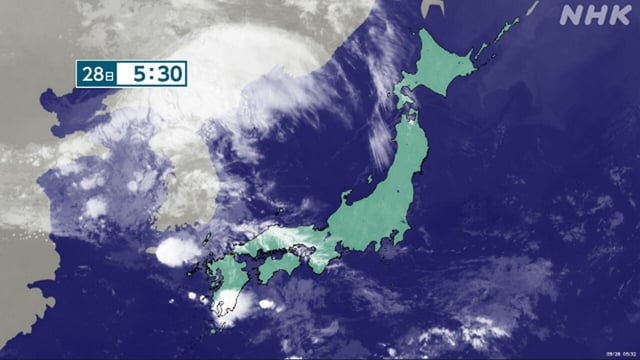
- Japan’s Meteorological Agency reports very unstable air from northern to western regions, with hourly deluges including 73.5 mm at Wajima’s Mitsui and 53.5 mm in Yamaguchi after 4 a.m.
- Authorities urge vigilance for landslides, urban and lowland flooding, river rises, lightning, tornado‑like violent gusts, and hail through Monday night.
- Forecast 24‑hour rainfall totals peak at about 120 mm in Tohoku and 100 mm in Hokuriku and Niigata by Monday evening.
- In Ishikawa’s Noto area, two men were rescued without injury after a flooded roadway stranded their car early Monday.
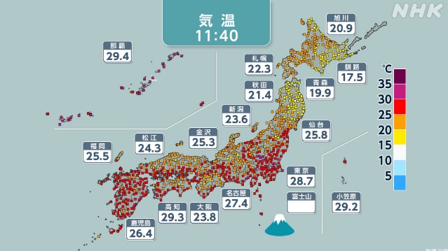
- Even as rain bands pass, Pacific‑side areas are seeing out‑of‑season heat with many locations topping 30°C, and Okinawa stays mostly fair under high pressure with lingering swells and isolated thunderstorms.