Overview
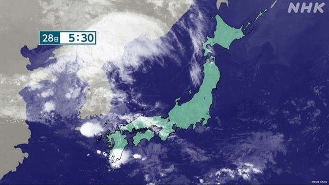
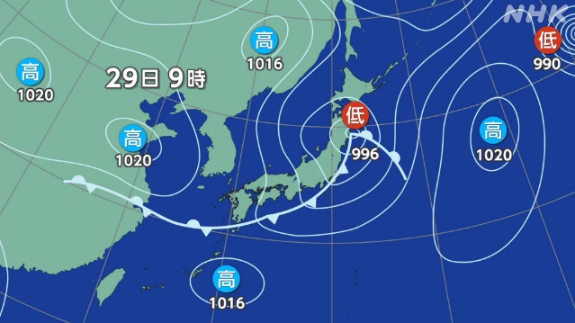
- Japan Meteorological Agency says a low forming on a front over the Sea of Japan will move east across Honshu through Sept. 29, making conditions very unstable from northern to western Japan.
- Early on Sept. 28, intense convection produced 51.5 millimeters of rain in one hour at Akune, Kagoshima, illustrating the risk of short‑duration heavy rain.
- Latest guidance calls for vigilance against flooding, landslides, river rises, lightning, hail and tornado‑class gusts as the system deepens and colder air aloft arrives.
- Fukuoka District Meteorological Observatory updated its disaster‑prevention comment, warning of thunderstorms and heavy rain through early Sept. 29 with localized hourly peaks near 30 millimeters and 24‑hour totals up to 80 millimeters in parts of northern Kyushu.
- Okinawa remains mostly sunny under a Pacific high, but forecasters note brief showers or thunderstorms in places and elevated coastal waves, with high seas around the Daito Islands.