

Overview
- Forecasters expect the season’s first hard freeze in many inland areas from New England to Pennsylvania, with widespread frost/freeze headlines and lows dropping into the 20s and 30s by Friday morning.
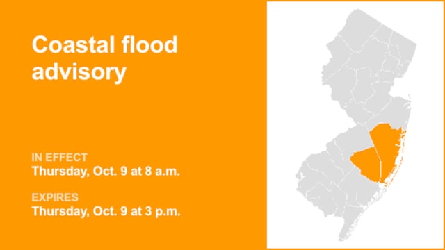
- A coastal low is developing off the Carolinas and is forecast to lift north Sunday into Monday, bringing periods of rain, strong onshore gusts near tropical-storm force at the coast, and a risk of coastal flooding during higher astronomical tides.
- Advisories span multiple regions, including Freeze Warnings and Frost Advisories across New England, a Freeze Watch in parts of Pennsylvania, a Lake Wind Advisory in the CSRA, a Wind Advisory in Flagler County, and coastal flood alerts along Florida’s east coast due to king tides.
- Behind the front, many communities turn cool, dry, and sunny through Saturday with highs mainly in the 50s and 60s in the Northeast and 60s to low 70s in the Mid-Atlantic, as breezy northeast winds ease into the weekend.
- In the tropics, Tropical Storm Jerry is forecast to pass near the Leeward Islands under tropical storm watches and could approach near Bermuda early next week, while a Bay of Campeche disturbance has low chances for development.