Overview
- Flood watches cover western and central Texas and southeast New Mexico through Sunday afternoon, with meteorologists forecasting 2 to 5 inches of rain and isolated amounts up to 8 inches.
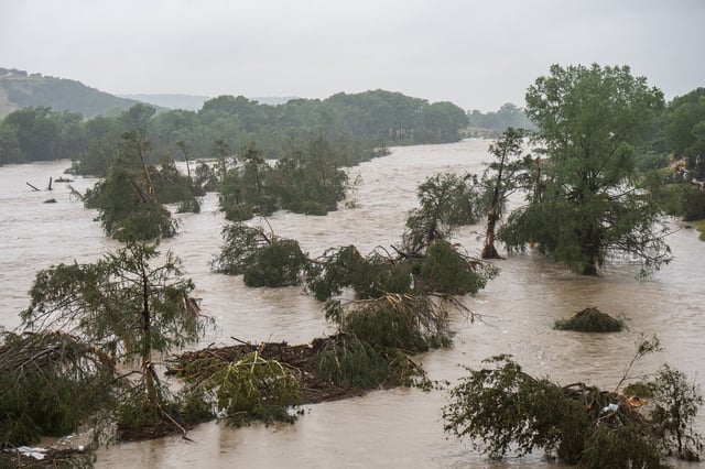
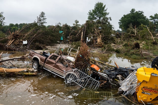
- Soils already saturated from recent 1-in-1,000-year rainfall events heighten the risk of fresh flash flooding in vulnerable hill and burn-scar regions.
- Severe thunderstorms threaten parts of the Midwest this weekend, placing about 19 million people from northern Missouri to western Michigan under hazardous storm warnings.
- At least 120 people have died in Texas Hill Country and three in the mountain village of Ruidoso, New Mexico, with North Carolina still assessing its toll after Tropical Storm Chantal.
- Climate experts note that a warmer atmosphere holds roughly 3 to 4 percent more moisture per degree of warming, making extreme downpours increasingly frequent and intense.