Overview
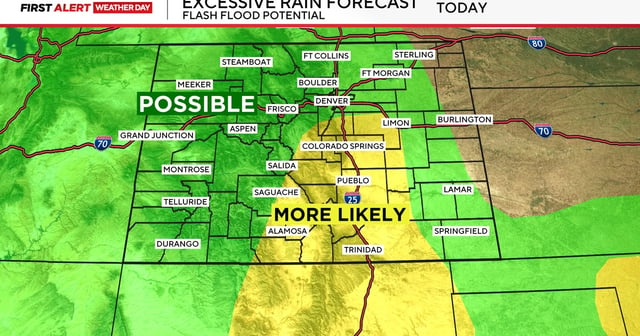
- Flood Watches are in effect from noon through the evening for parts of the Pikes Peak region and southeastern counties, including El Paso, Teller, Pueblo, Fremont and Las Animas.
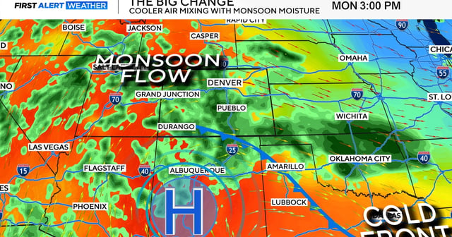
- Storms are expected to form over the mountains and foothills before pushing east along the I‑25 corridor, with Monday highlighted as the most widespread day for showers and thunderstorms.
- Localized cloudbursts could trigger rapid runoff and flash flooding over burn scars and low‑lying areas, and the National Weather Service urges drivers to turn around rather than enter flooded roads.
- Severe hazards remain possible, with NWS Pueblo noting potential hail up to 1.5 inches and 60 mph winds in the Pikes Peak region after a weekend watch in the southeast called for hail up to 2 inches and winds to 70 mph.
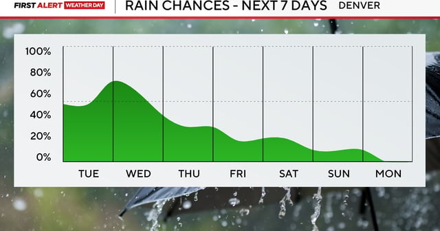
- Highs stay below normal in the 60s and 70s along the Front Range, with daily storm chances persisting through the week even as moisture gradually diminishes.