Overview
- The National Weather Service has issued flood watches through Sunday evening for much of the Texas Hill Country and Interstate 35 corridor, including Austin, Kerrville and San Antonio
- Meteorologists forecast localized rainfall of 1 to 3 inches with isolated pockets of up to 8 inches over the weekend, posing renewed flash flood hazards on waterlogged ground
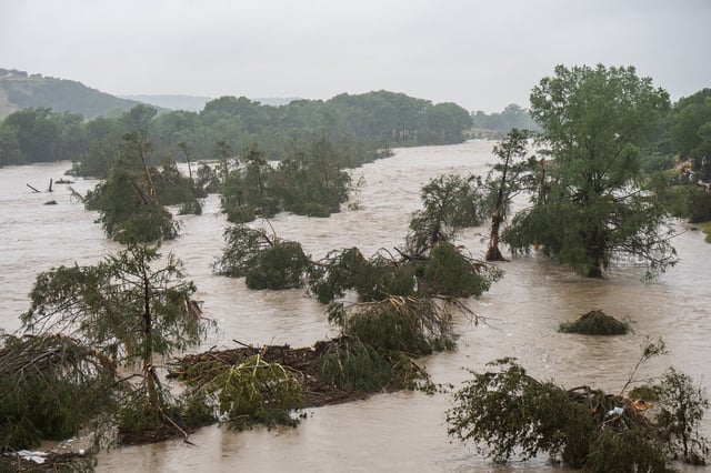
- Recovery efforts continue after four 1-in-1,000-year storms last week left more than 125 people dead and caused widespread infrastructure damage across Texas and neighboring states
- Thin soils over bedrock in the Hill Country, coupled with wildfire burn scars, have exacerbated runoff and amplified flood severity in hilly and recently burned areas
- Experts warn that a warming atmosphere’s enhanced moisture capacity is increasing the frequency and intensity of extreme rainfall events