

Overview
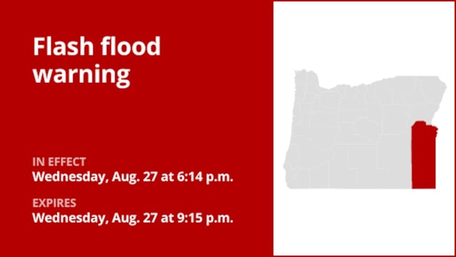
- The National Weather Service issued the warning at 6:14 p.m., in effect until 9:15 p.m., reporting 1 to 2 inches of rain already fallen and rates of 1.5 to 2.5 inches per hour with flash flooding ongoing or imminent.
- Additional rainfall of 0.5 to 1 inch was possible, with flooding expected in small creeks and streams as well as poor-drainage and low-lying areas.
- A separate flash flood watch was posted through 11 p.m. for Oregon’s Lower Treasure Valley, including Baker and Malheur counties, for the potential of excessive rainfall.
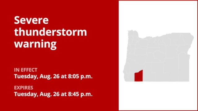
- Radar-indicated thunderstorms also produced penny- to marble-sized hail and wind gusts up to 40 mph across the Klamath Basin, the Siskiyou and Southern Oregon Cascades, and parts of Curry, Josephine, Jackson, Harney and Malheur counties.
- Officials urged drivers to avoid flooded roads, advised residents to move to higher ground when necessary, and reinforced lightning safety guidance as storms continued to track across the region.