


Overview
- A flash flood warning in effect until 6 p.m. EDT covers Alpena and Presque Isle counties after Doppler radar measured 1–2 inches of rain and forecasts rapid urban and creek flooding.
- A severe thunderstorm watch remains active through 10 p.m. for southwest and south-central Lower Michigan, where storms may produce isolated gusts up to 70 mph across Muskegon, Grand Rapids and Kalamazoo.
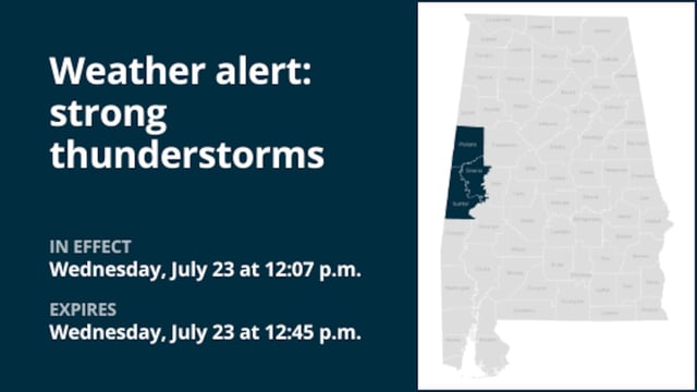
- Escambia and Covington counties in Alabama received strong thunderstorm warnings for gusts up to 50 mph, raising concerns about downed tree limbs, property damage and localized flash flooding.
- The severe weather system stretches from Michigan’s Great Lakes through the Deep South, underscoring the volatile nature of peak-season storms that can bring hail, lightning and isolated tornado threats.
- Residents are urged to seek sturdy indoor shelter, avoid driving through flooded roads and monitor real-time National Weather Service updates for sudden changes.