Overview
- Behind a passing cold front, much cooler, drier air has settled in with Freeze Warnings and Frost Advisories from Pennsylvania and Maryland to New England, including a likely first hard freeze in parts of New Hampshire and Massachusetts tonight into Friday.
- Gusty conditions persist with 25–35 mph gusts in spots and Lake Wind Advisories in effect in some Southeast areas, keeping waters choppy and outdoor items vulnerable.
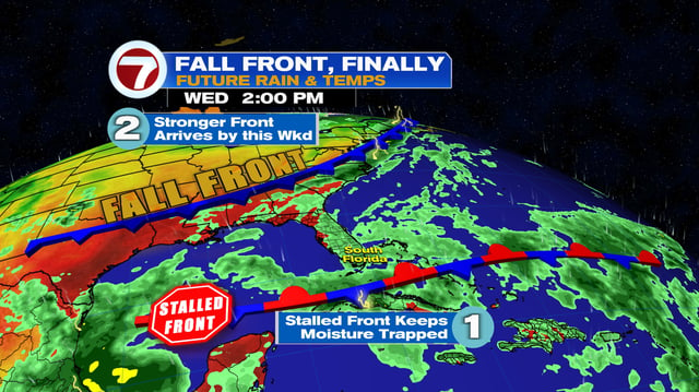
- Forecast models indicate a coastal low forming off the Carolinas this weekend that could lift north Sunday–Tuesday with periods of rain, stronger onshore gusts and high‑tide flooding; the storm’s exact track remains uncertain.
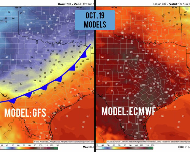
- The Gulf Coast enters a multi‑day dry stretch with lower humidity and mid‑80s highs, while parts of Texas remain unusually warm near 90 degrees even as southeast Texas sees a brief, cooler morning respite.
- Tropical Storm Jerry is expected to strengthen over the Atlantic into a hurricane but remain east of the U.S. with no direct impacts currently forecast.