
Overview
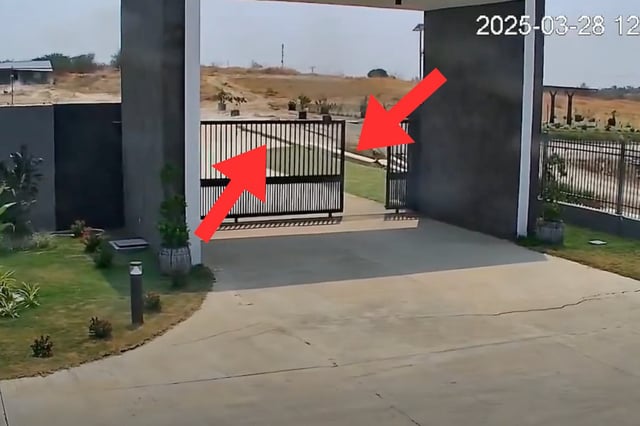
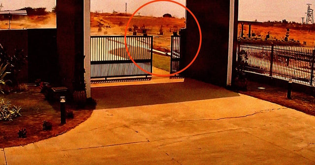
- A security camera in Tha Pyay Wa, Myanmar, captured the first known video of a fault surface rupture during the M7.7 earthquake on March 28, 2025.
- The footage reveals right-lateral strike-slip movement, with one side of the land sliding several feet past the other, causing visible damage to infrastructure.
- The earthquake, which originated along the Sagaing Fault, propagated a supershear rupture over 460 kilometers, with displacements exceeding six meters in some areas.
- Satellite radar images from Copernicus Sentinel-1 corroborate the ground-level video, showing before-and-after displacement across the region.
- The quake resulted in at least 4,900 fatalities, extensive infrastructure damage, and ongoing analysis by researchers to refine models of fault behavior.