Overview
- At a Sept. 23 ceremony in Albuquerque, the FBI handed the map to representatives of Mexico’s National Archives.
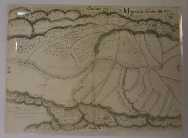
- The planning map, created in 1776 by a Spanish captain, depicts Santa Fe during Spanish provincial rule.
- Mexico’s archives reported the map missing in 2011 after discovering a torn page, and it was later located in a Santa Fe library.
- FBI Special Agent in Charge Justin Garris framed the return as restoring cultural heritage, with Mexican Consul Patricia Pinzón and local officials attending.
- Officials linked the document to the Camino Real de Tierra Adentro and said it joins a broader effort to recover roughly 2,000 archival items.