

Overview
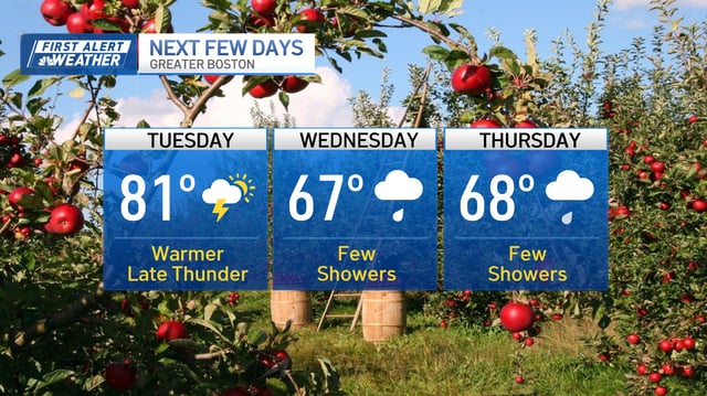
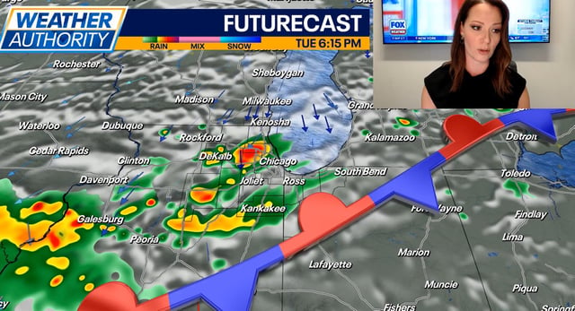
- Tuesday brings above‑normal warmth and rising humidity, with showers and a few thunderstorms spreading in Tuesday night into Wednesday across New England and the Northeast.
- A stronger front later Thursday into early Friday is favored to produce the week’s best measurable rain and a noticeable drop in temperatures.
- Drought persists across parts of New England, so any rainfall will be uneven and insufficient to eliminate deficits.
- Hurricane Gabrielle has strengthened into a major hurricane over the central Atlantic and is curving north and east well away from Bermuda and the U.S. mainland.
- Regionally, Northern California faces late‑season heat near or above 100 degrees Tuesday before cooling midweek, and a separate system is supporting stronger storms across portions of eastern Nebraska and western Iowa.