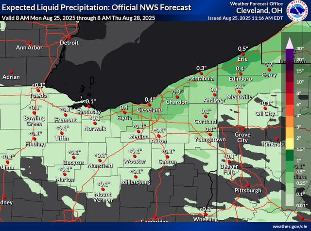
Overview
- Spotty lake-effect bands are producing showers through Tuesday with locally heavy downpours concentrated in the primary snowbelt.
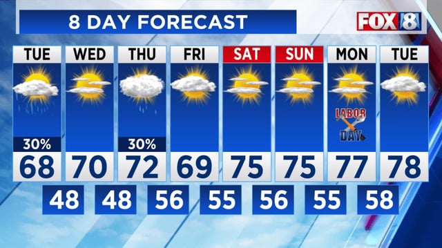
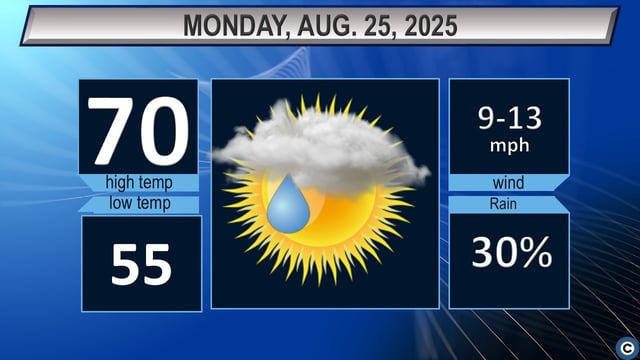
- Tuesday is expected to be the coolest day of the week with highs struggling to reach 70 degrees and temperatures running 10–15 degrees below normal.
- Overnight lows away from the lakeshore may drop into the upper 40s, with a few locations flirting with record territory.
- A Small Craft Advisory and a Beach Hazard Statement are in effect as 2–5 foot waves, rip currents, and possible waterspouts create dangerous conditions on Lake Erie.
- High pressure is forecast to bring a dry, sunnier window Wednesday before a late-Thursday into Friday front brings another chance for showers and a few storms.