

Overview
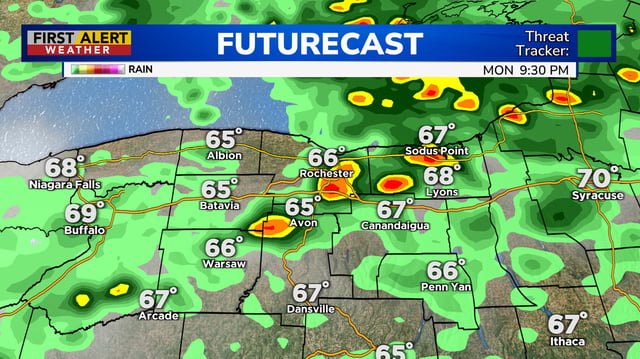
- Scattered showers and thunderstorms expand Tuesday into midweek across the Midwest, Northeast and Appalachians, with isolated strong storms capable of damaging winds, heavy rain and small hail.
- Most spots are forecast to receive a few tenths to around an inch of rain, with locally higher totals in downpours, providing patchy but helpful drought relief.
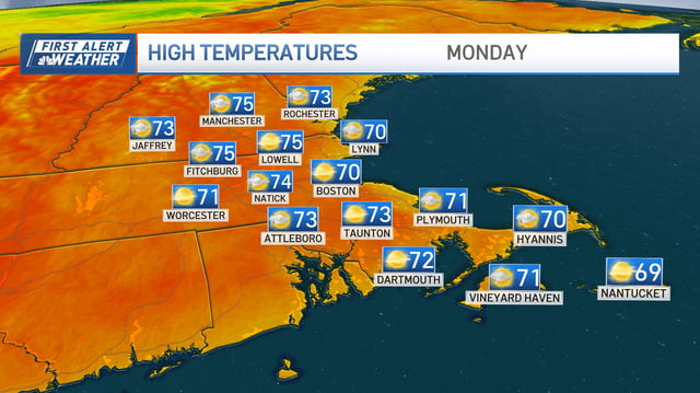
- Temperatures run warm to start the week before a midweek frontal passage ushers in cooler, more seasonable readings late week.
- The National Hurricane Center lists Hurricane Gabrielle over the Atlantic, with forecasters monitoring the storm for short‑term strengthening while it stays offshore.
- Subtropical moisture is expected to reach Southern and Central California on Tuesday with light showers likely and low flood risk unless thunderstorms develop.