Overview
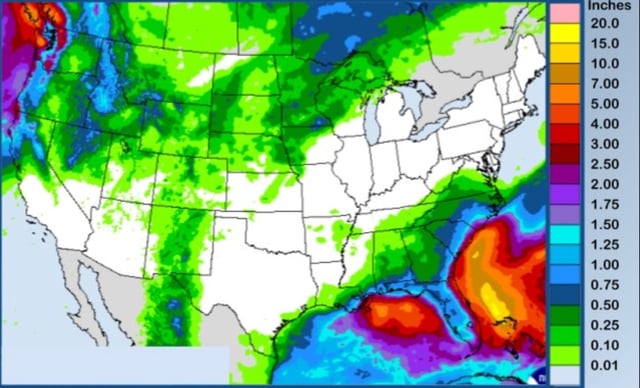
- Many areas finish September warmer and drier than normal, with spots like San Antonio logging just 1.29 inches for the month, among its drier Septembers on record.
- Pacific Northwest and parts of the West turn cooler with periodic showers this week, while the northern Rockies could see early high‑elevation snow with snow levels near 8,000–9,000 feet.
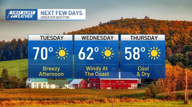
- Midweek brings more seasonable air east of the Appalachians, including chilly nights and patchy frost in interior New England and northern areas.
- Swell from offshore tropical systems, including Hurricane Narda’s remnants, is driving elevated surf and strong rip currents on west‑facing beaches, with Beach Hazard Statements calling for 3–6 foot breakers.
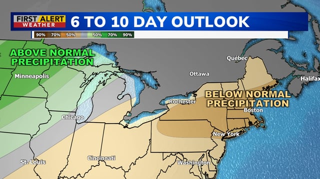
- The cool spell looks short‑lived, with many forecasts calling for a warm, sunny first weekend of October and only limited, uneven precipitation, leaving drought and wildfire concerns in place.