
Overview
- The National Weather Service has issued hazardous heat warnings for August 8–10 in Central through Southern California.
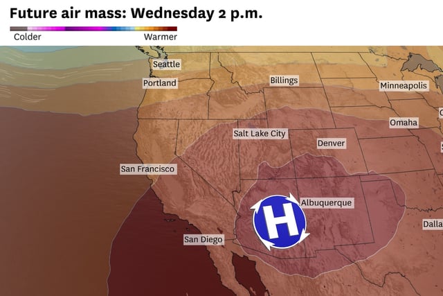
- Forecasts indicate the strongest August ridge on record will push temperatures above 100°F statewide, with up to a 50 percent chance of reaching 110°F in the San Joaquin Valley.
- Bay Area highs are expected to peak in the lower 90s by Wednesday even as gale-force gusts up to 40 mph elevate fire weather concerns in coastal and hill areas.
- Onshore breezes amplified by the ridge will keep coastal and Bay Area temperatures significantly cooler than interior regions.
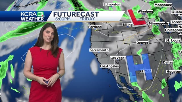
- Meteorologists warn that low humidity and gusty winds will elevate fire weather risk in the East Bay hills and Santa Lucia range.