
Overview
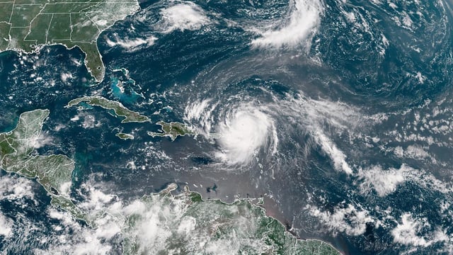
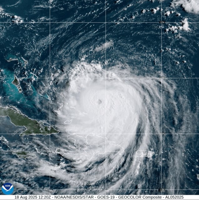
- Now a major hurricane, Erin is forecast to turn north between the U.S. East Coast and Bermuda with the core remaining offshore through midweek.
- Mandatory evacuations are in place for Hatteras and Ocracoke islands, with coastal flooding expected to begin Tuesday and peak Wednesday into Thursday.
- Forecasters warn of life‑threatening surf and rip currents from the Bahamas to Atlantic Canada, with 15–20+ foot waves likely to overtop dunes and inundate parts of North Carolina’s Highway 12.
- Alerts include a tropical storm warning for the Turks and Caicos and the southeast Bahamas, a tropical storm watch for the central Bahamas and parts of the North Carolina coast, and a storm surge watch from Cape Lookout to Duck.
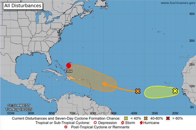
- Puerto Rico saw about 147,000 power outages that are now mostly restored, and a trailing tropical wave has a 60% chance of development, signaling continued hazardous marine conditions.