

Overview
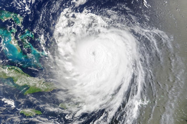
- Hurricane Erin remained a large Category 2 late Thursday with 100–105 mph winds as it accelerated away from the Mid-Atlantic toward the open Atlantic.
- Outer Banks communities saw overwash and closures, with parts of Highway 12 shut and Ocracoke’s ferry access cut off after dunes were breached.
- High surf, strong rip currents and tidal flooding stretched from the Carolinas to New England, with major high‑tide flooding risk flagged for parts of New Jersey and Long Island.
- Authorities reported dozens of rip‑current rescues in North Carolina this week, and several coastal cities restricted or closed swimming as hazardous seas persisted.
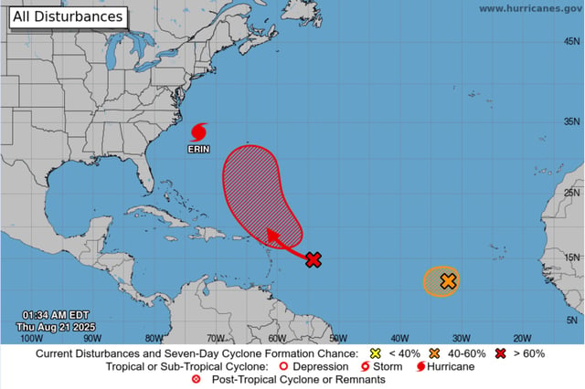
- Forecasters expect Erin to weaken and turn post‑tropical by Saturday, while the NHC tracks additional Atlantic disturbances with medium‑to‑high seven‑day development odds that could yield Fernand.