
Overview
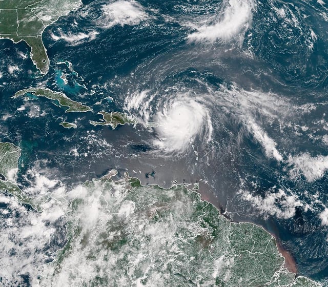
- The National Hurricane Center reports Erin regained Category 4 strength with roughly 215 km/h (130 mph) winds as outer bands reach Turks and Caicos and the southeast Bahamas.
- Hurricane-force winds extend about 95 km from the center and tropical-storm-force winds reach roughly 370 km, with the wind field expected to grow.
- Evacuations were ordered for Hatteras by Dare County, with Ocracoke also under an evacuation order, as officials warned pounding surf could overwash N.C. 12 and flood low-lying areas.
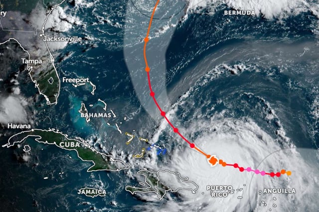
- Forecast guidance turns the center north between the U.S. East Coast and Bermuda through midweek, keeping the core over water but sending dangerous swells and rip currents toward the U.S., the Bahamas, Bermuda and Atlantic Canada.
- Puerto Rico saw about 147,000 power outages and more than 20 flight cancellations as outer bands passed, and the U.S. Coast Guard later reopened island ports as conditions eased.