Overview
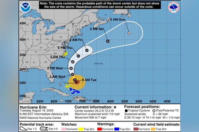
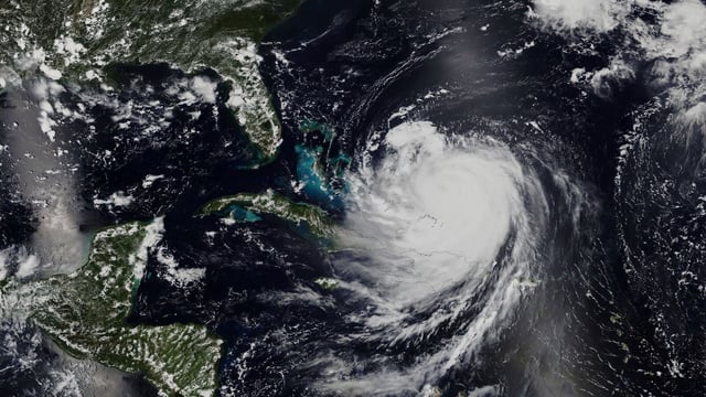
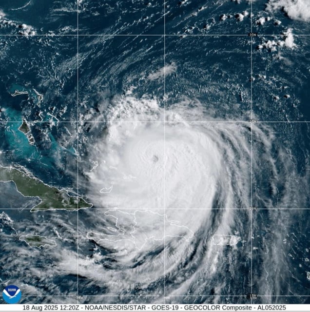
- As of Tuesday, Erin was about 720 miles south-southeast of Cape Hatteras with sustained winds near 110 mph, moving northwest around 7–9 mph as forecasters flagged likely strength fluctuations and further growth in size.
- Hurricane-force winds extend up to roughly 80 miles from the center and tropical-storm-force winds to about 205 miles, underscoring the broad reach of hazardous seas and rip currents from the Bahamas to Atlantic Canada.
- A Storm Surge Warning is in effect from Cape Lookout to Duck, North Carolina, with 2–4 feet of surge possible, and Tropical Storm Warnings cover Beaufort Inlet to Duck and the Turks and Caicos and southeast Bahamas, with the closest approach to the Carolinas late Wednesday into Thursday.
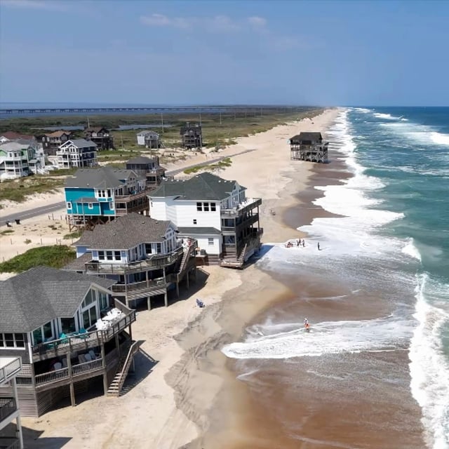
- Dare and Hyde counties declared states of emergency and ordered mandatory evacuations for Hatteras and Ocracoke Islands as officials warn of 15–20 foot surf-zone waves, coastal flooding, dune erosion, and likely overwash closing portions of NC Highway 12.
- High surf and rip current risks are prompting beach closures and rescues along the coast, including 50–70 rescues at Wrightsville Beach on Monday and about 144 at New Hampshire’s Hampton Beach over six days, while forecasters also monitor two trailing disturbances with roughly 60% and 30% seven-day development odds, one likely nearing the Leeward Islands by Friday.