

Overview
- High pressure continues to drive sunny, dry weather with highs widely in the upper 70s to mid‑80s and some near 90 degrees.
- Gusty southerly winds are common, with many areas seeing 25–35 mph gusts and isolated peaks near 40 mph, prompting elevated fire danger alerts from the National Weather Service.
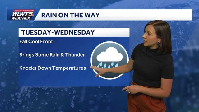
- Timing varies by region: the Plains, including Omaha and parts of Kansas City’s area, see showers and storms Sunday night into Monday, while many Great Lakes and Northeast spots look to Tuesday night into Wednesday.
- Rain tied to the front looks limited, with many forecasts calling for roughly a quarter to a half inch at most, which will not significantly ease short‑term drought in places like New England.
- Behind the front, highs trend back to seasonable or cooler levels mid‑to‑late week, commonly in the 50s and 60s with some 70s lingering just ahead of the change.