

Overview
- Snow levels in Colorado and parts of Montana drop to roughly 9,000–10,000 feet, with light accumulations possible on high passes late Monday night into Tuesday.
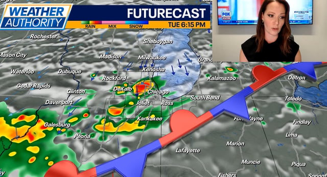
- Tuesday into Wednesday features the broadest rain window, with showers and isolated thunderstorms from the Plains and Midwest to the Northeast and parts of the West, offering uneven but welcome drought relief.
- Breezy to gusty conditions accompany the system, with widespread gusts near 20–30 mph and higher bursts in thunderstorms.
- Northern California holds late-season heat on Tuesday with some Valley highs near 100, then turns cooler midweek as a nearby cutoff low introduces limited shower chances.
- Most guidance shows the system exiting by midweek as high pressure rebuilds, while Hurricane Gabrielle strengthens well offshore in the Atlantic with no direct U.S. land threat.