Overview
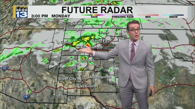
- Rain and isolated thunderstorms spread along the I‑25 corridor Monday as north winds gusted near 30 mph behind the front.
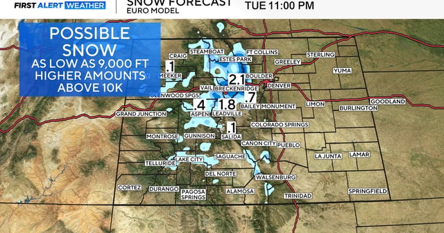
- A winter weather advisory takes effect overnight into Tuesday with snow levels near 9,000 feet and slick travel possible over high mountain passes.
- Tuesday marks the coolest, wettest day for the Front Range and high country, with metro highs in the 50s to low 60s and accumulating snow above treeline.
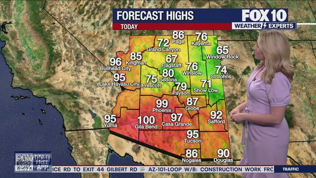
- Elsewhere in the West, Phoenix logged light morning showers before a brief dry, hotter stretch and renewed storm chances late week, while parts of Montana faced a frost advisory before a warm, dry ridge takes over.
- Forecasts agree the system exits by midweek, with sunshine returning and temperatures rebounding into the 70s and 80s to close the week across much of the Rockies and Plains.