


Overview
- DWD has issued a preliminary alert for severe thunderstorms focused on the south, with county-level warnings to be updated as the situation evolves.
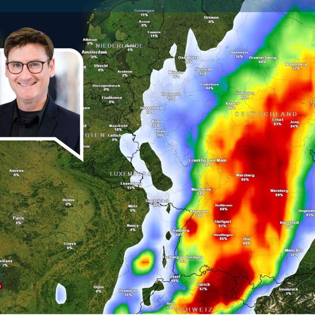
- Main hazards late Thursday into the night include short‑period rain of 25–40 l/m² (lokal bis 60), hail up to about 3 cm, and storm‑force gusts around 100–110 km/h.
- Storms are forecast to initiate in the southwest (Rhineland‑Palatinate, Baden‑Württemberg), intensify over Bavaria by evening, then shift east/northeast overnight with broader heavy rain on Friday.
- Risk hotspots cited include Schwaben, Franken and parts of Ober- und Niederbayern, while NRW and the north expect weaker convection and mainly Friday rain after a warm Thursday.
- Models and DWD guidance indicate a rapid easing from the west on Friday, leading into a brief, sunnier late‑summer weekend.