


Overview
- The DWD has raised its warning to Alarmstufe Violett for Mecklenburg-Vorpommern, Rostock, Stralsund and parts of Rügen as up to 140 L/m² of rain is expected between Monday afternoon and Tuesday morning.
- Berlin and Brandenburg remain under high-level alerts with forecasts of 20–60 L/m² of rain and the Berlin Fire Department on heightened readiness for flooding.
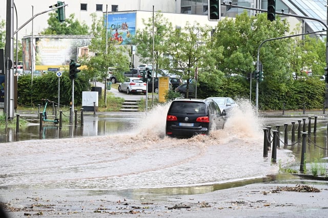
- Flooded underpasses and blocked highways have been reported, Deutsche Bahn has halted train services after trees fell on tracks and the A72 was temporarily closed due to rising water.
- Earlier on Sunday and Monday, western and central regions saw gusts of 95–110 km/h with hail that prompted Alarmstufe Rot warnings in 48 districts.
- Forecasters say a deep low-pressure complex over Western Europe is drawing warm, moist Mediterranean air into cooler Atlantic currents, driving the nationwide storm surge.