Overview
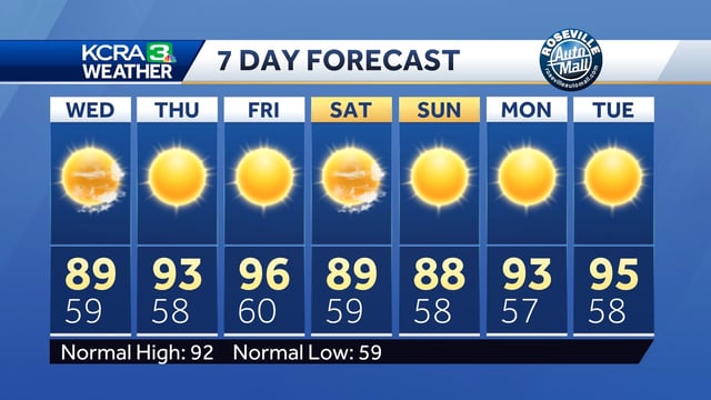
- Enhanced Delta breezes and an expanding marine layer have driven midweek valley highs down to the upper-80s and low-90s.
- Forecast models show a short-lived warming trend Thursday into Friday, with inland highs approaching 100°F on Friday.
- A late-season storm system from the Pacific Northwest is expected to unleash cooler air and lower coastal temperatures by 5–15°F over the weekend.
- The National Weather Service has issued beach hazard statements warning of sneaker waves and strong rip currents along the North Bay and Northern Monterey Bay.
- Local advisories designate multiple heat Impact Days for vulnerable populations, and isolated afternoon thunderstorms remain possible in the Sierra south and east of Lake Tahoe.