Overview
- The NODSSUM expedition mapped approximately 3,350 barrels across a 163 km² area of the Western European Basin aboard the research vessel L’Atalante.
- Teams deployed the Ulyx submersible equipped with 3D imaging and sonar to chart barrel positions and capture high-resolution photographs.
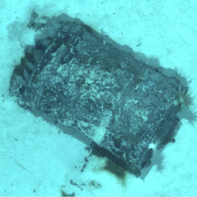
- Inspections showed barrel conditions ranging from intact to heavily deformed or ruptured, with many surfaces corroded and colonized by anemones.
- Initial imagery revealed unknown bitumen-like binding material seeping from several containers, suggesting long-term structural breaches.
- Radiation instruments recorded only natural background levels at all surveyed sites, while fine-scale laboratory analyses of collected samples will continue for months.


