Overview
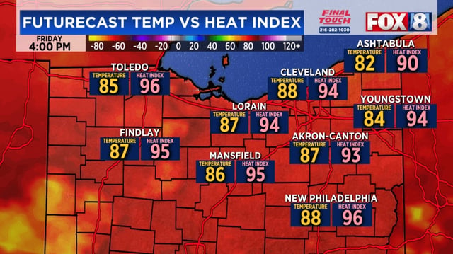
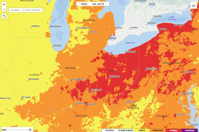
- Heat indices are climbing toward 100°F under an NWS Level 3 major risk advisory for Saturday afternoon.
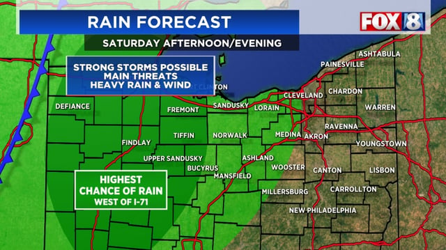
- Scattered to numerous thunderstorms are developing along the I-75 corridor, posing downpour and wind-damage threats to western communities.
- Rain and storm chances will move east of I-77 on Sunday as a slow-moving cold front sweeps through the region.
- The strongest storms may unleash damaging wind gusts, locally heavy rainfall and isolated flooding due to persistent heat and humidity.
- High pressure is forecast to build in early next week, bringing drier conditions and highs back to the mid-80s.