Overview
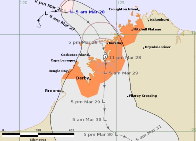
- The Bureau of Meteorology forecasts Cyclone Dianne will make landfall between Kuri Bay and Cape Leveque as a Category 1 system on Friday night or early Saturday morning.
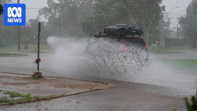
- Damaging wind gusts of up to 100 km/h and heavy rainfall of 100-150 millimeters are expected, with additional rainfall likely over the weekend as the system moves inland.
- The cyclone is projected to weaken quickly after landfall, reverting to a tropical low by Saturday morning as it moves towards Fitzroy Crossing.
- Residents in Derby and surrounding West Kimberley communities have been urged to prepare for potential flash flooding and hazardous weather conditions.
- Cyclone Dianne, if officially named, will be the first cyclone to cross the Kimberley coast in the 2024-25 wet season, highlighting the region's ongoing vulnerability to severe weather events.