Overview
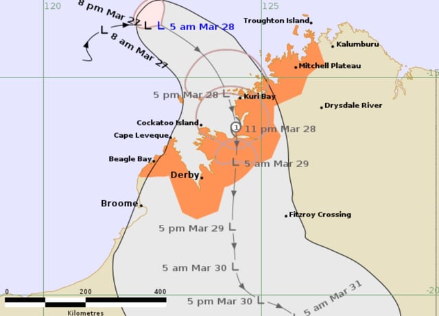
- The Bureau of Meteorology forecasts that tropical low 28U will form into Cyclone Dianne and cross the Kimberley coast between Kuri Bay and Cape Leveque within the next 24 hours.
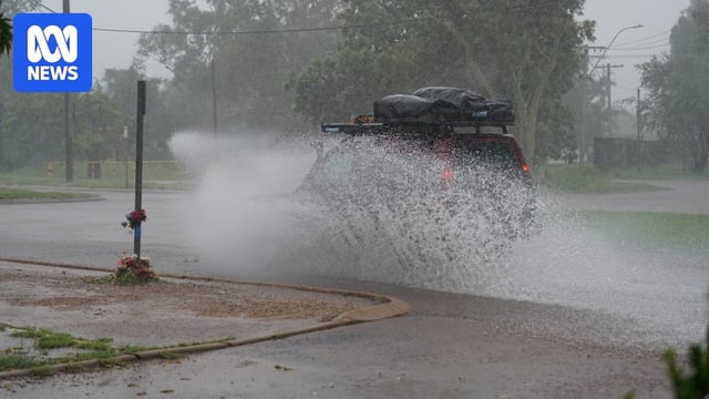
- Damaging wind gusts of up to 100 km/h and heavy rainfall of 100-150 millimeters are expected in coastal areas on Friday.
- Weather warnings have been issued for regions from Mitchell Plateau to Beagle Bay, including Derby, urging residents to prepare for dangerous conditions.
- The cyclone is projected to weaken back into a tropical low by Saturday morning as it moves inland, bringing additional rainfall to the Central Kimberley region over the weekend.
- If named, Cyclone Dianne will be the first cyclone of the 2024-25 wet season to impact the Kimberley coast.