

Overview
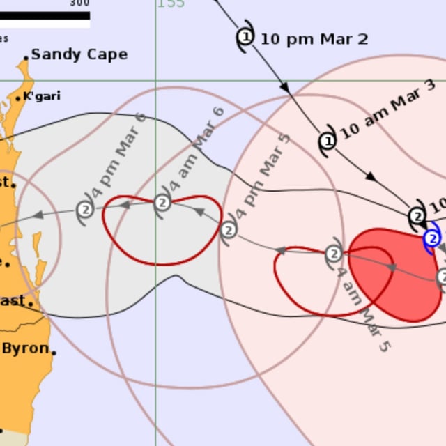
- Cyclone Alfred is forecast to make landfall between Brisbane and the Sunshine Coast late Thursday or early Friday as a Category 2 storm, with wind gusts up to 164 km/h.
- The storm has followed an unpredictable path in the Coral Sea but is now expected to sharply turn west toward southeast Queensland, a region that has not experienced a cyclone landfall in 50 years.
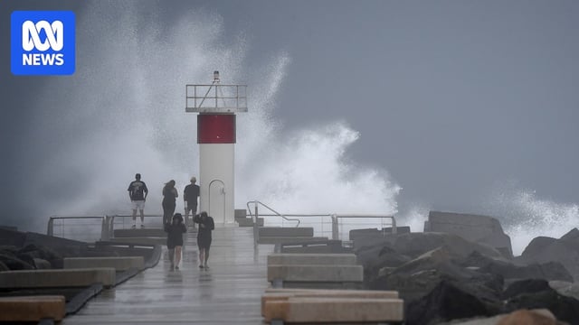
- Authorities warn of severe flash flooding, with up to 600mm of rain expected in some areas, affecting river catchments from Maryborough to northern New South Wales.
- Residents are urged to prepare emergency kits, secure property, and consider evacuation, especially in vulnerable coastal and island communities, while sandbagging stations and shelters are being set up.
- Meteorologists highlight Alfred's unusual ability to maintain intensity in subtropical latitudes, fueled by warm ocean waters and complex atmospheric conditions steering its erratic movement.